-Edgar Miller, Yadkin Riverkeeper
Yadkin Riverkeeper Edgar Miller took to the air again on March 25 with SouthWings pilot Holliday Obrecht, III and observer/YRK member Grace Broughton. The flight, provided by SouthWings and Mr. Obrecht, surpassed our expectations, yielding photos and insights to advance YRK’s major priorities, including enforcement of concentrated animal feeding operations or “CAFO” permits, assessment of existing and future river accesses on the Yadkin River State Trail and South Yadkin, and identifying other threats to the Yadkin and South Yadkin Rivers. The flights always remind us of the eternal beauty of the Yadkin watershed, its amazing history and the critical role it plays in sustaining our way of life. What follows is a series of photos highlighting many of the issues impacting the River taking off from the Davidson County airport near Lexington, flying upriver along the Davie/Forsyth border up to Yadkin, Surry and Wilkes counties and back down the South Yadkin over Alexander, Iredell, Davie and Rowan counties.
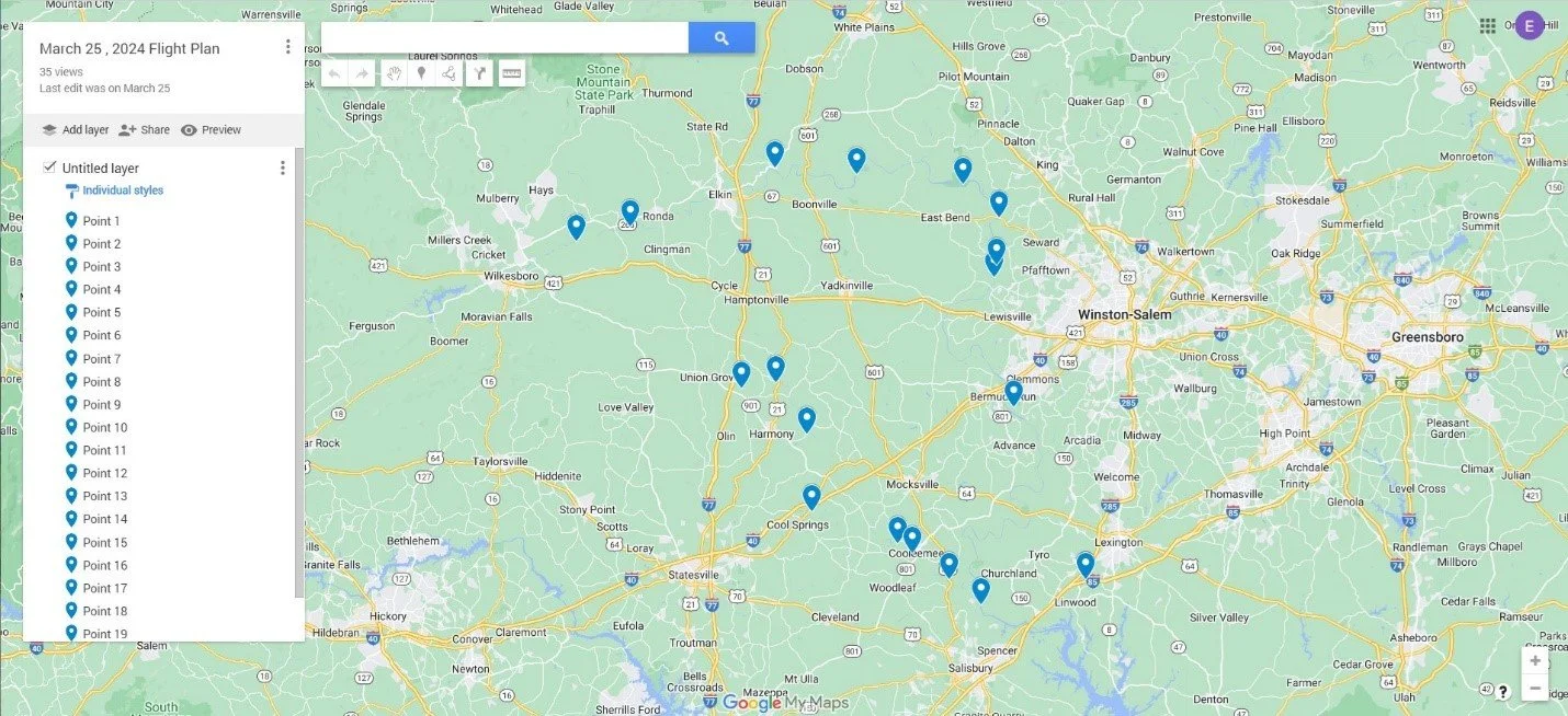
Flight 3169 Flight Plan – March 25, 2024
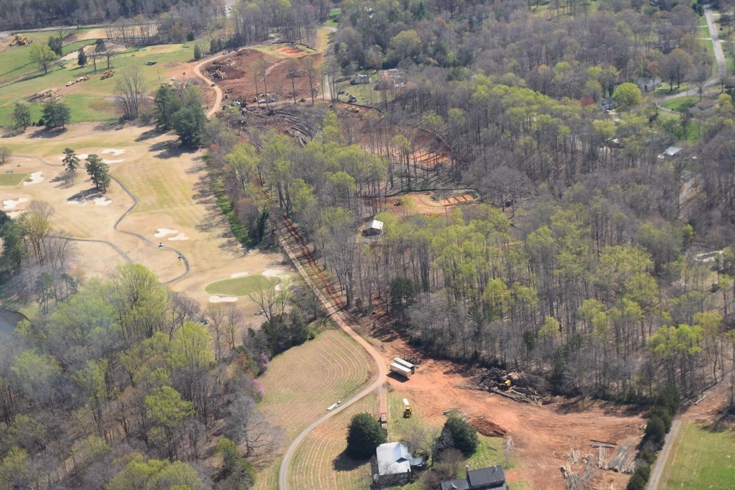
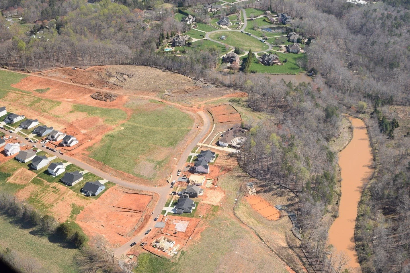
New development “Riverwalk” beside Tanglewood Park getting underway. YRK opposed the rezoning of “Yadkin River Conservation District” to higher density residential development.
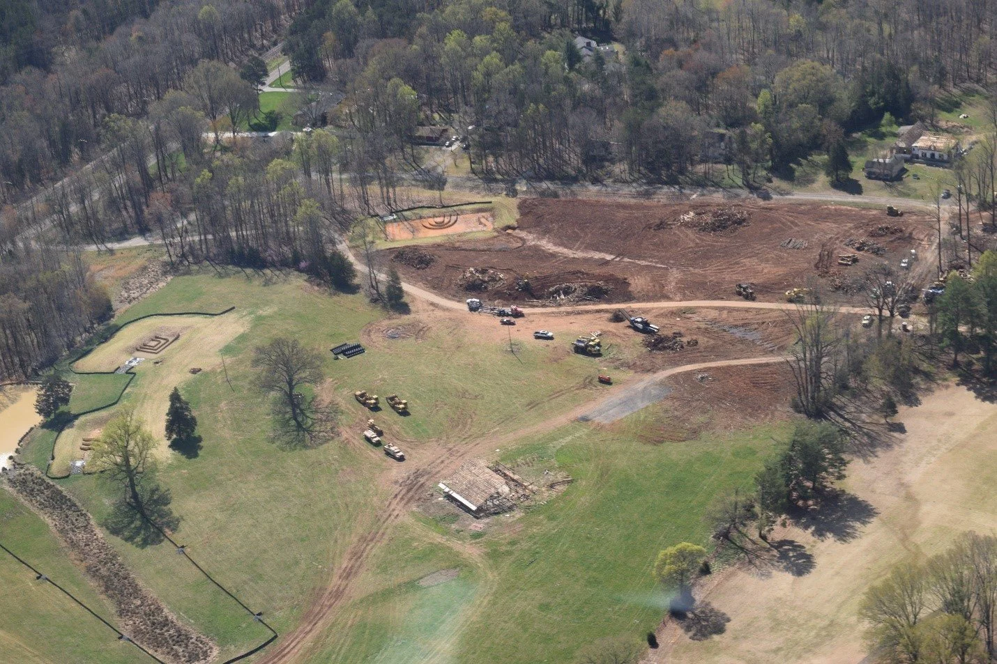
Recently installed retention ponds at “Riverwalk” already filling up with sediment. YRK and the residents who opposed the development are monitoring this very closely.
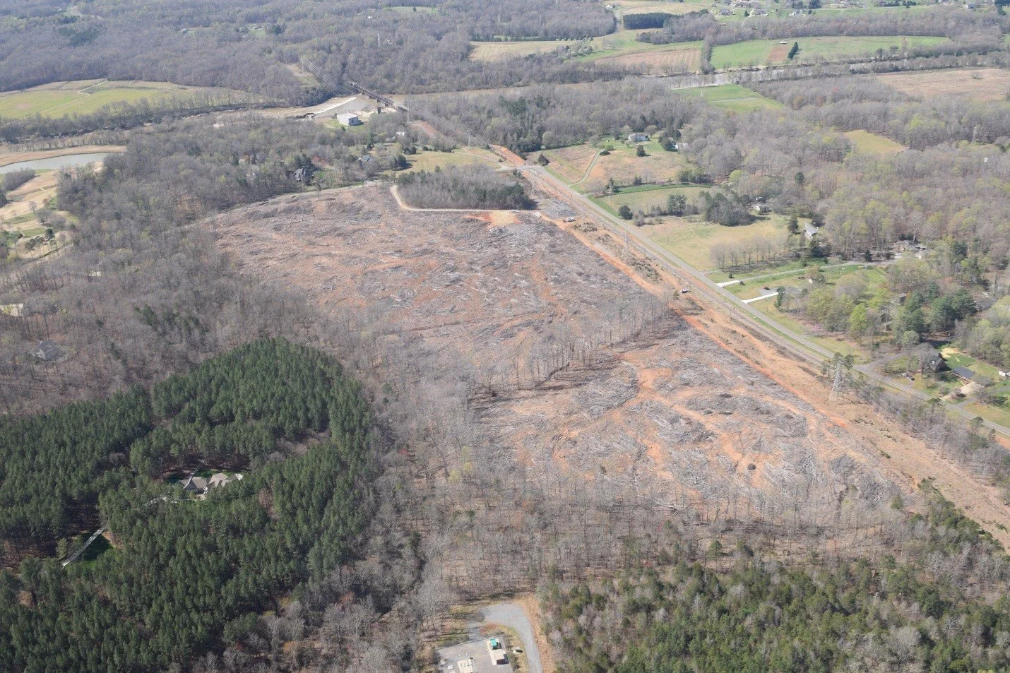
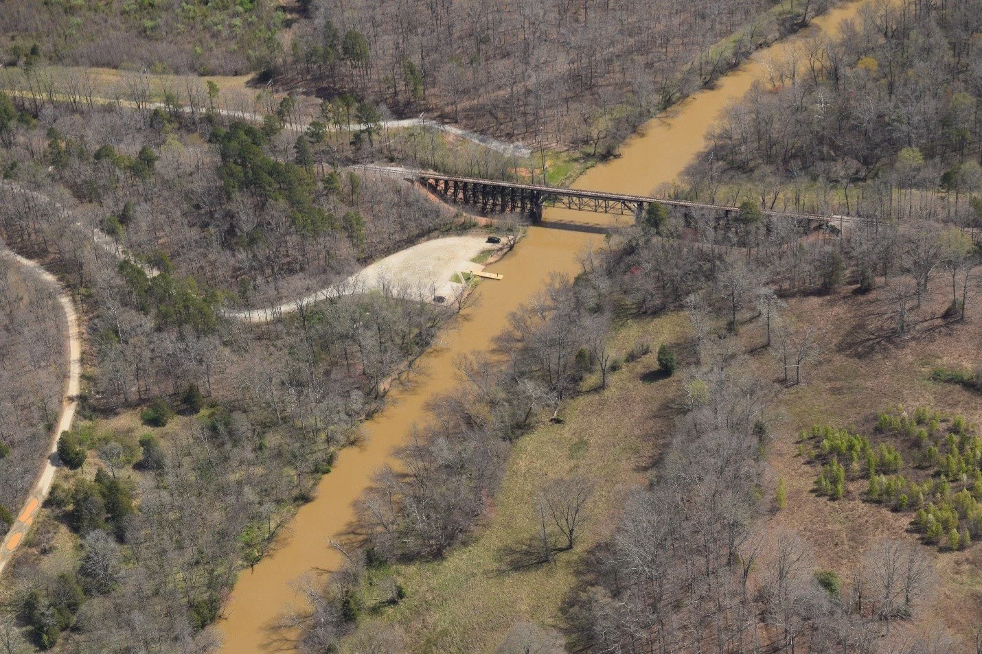
Nearby clearcut by the River near Idols Dam off Idols Road on Duke Energy property. YRK’s understanding is this will be reforested.
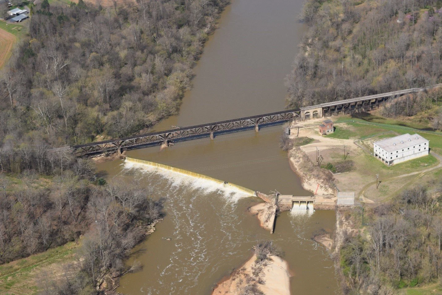
The historic Idols Dam, built in 1898, the first commercial hydroelectric dam in North Carolina. Yadkin River State Trail portage trail is at the left center of the photo and needs some improvement.
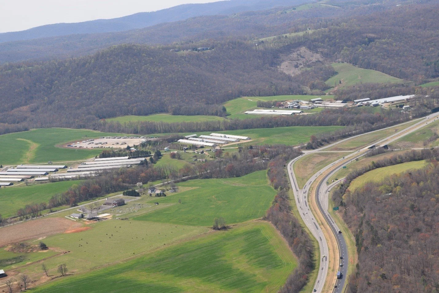
Unchecked development impacting water quality near the River off Conrad Farm Road.
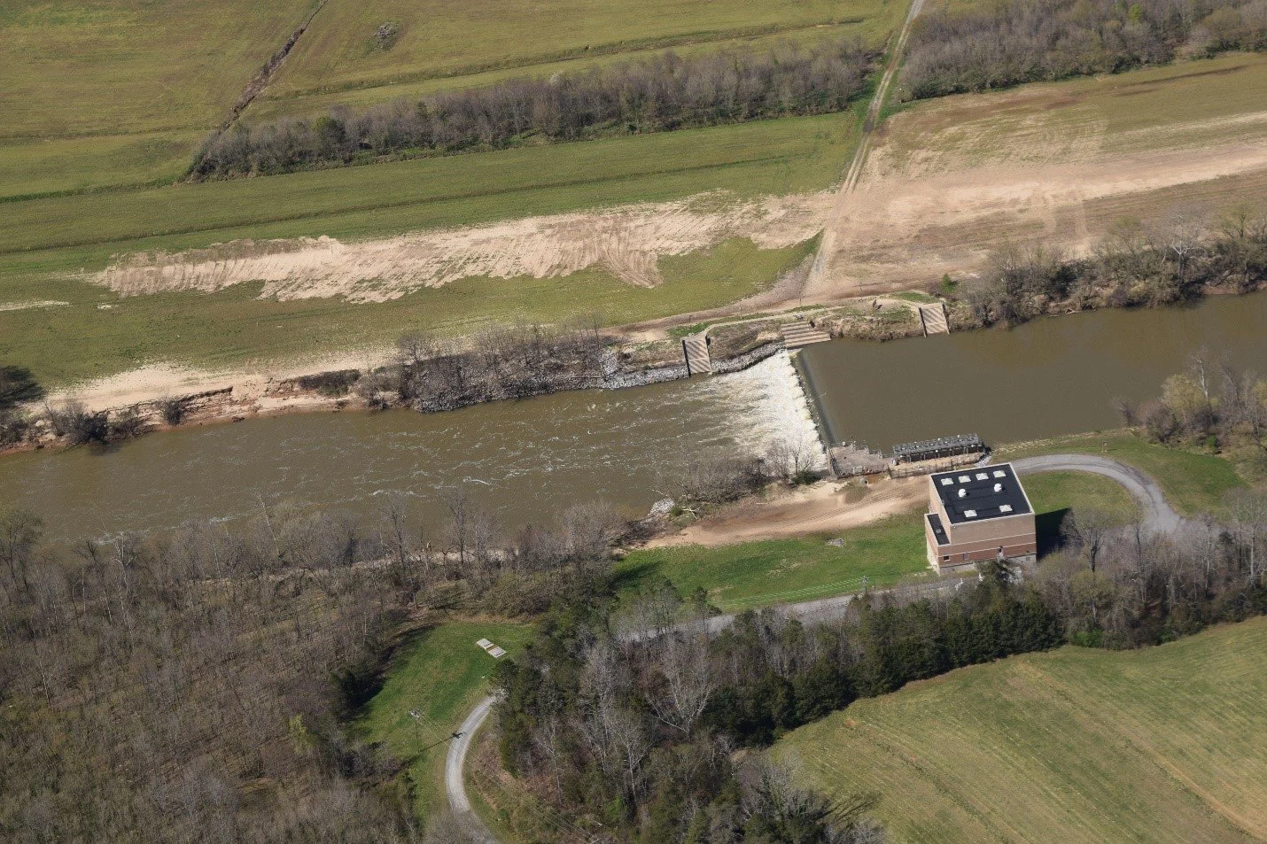
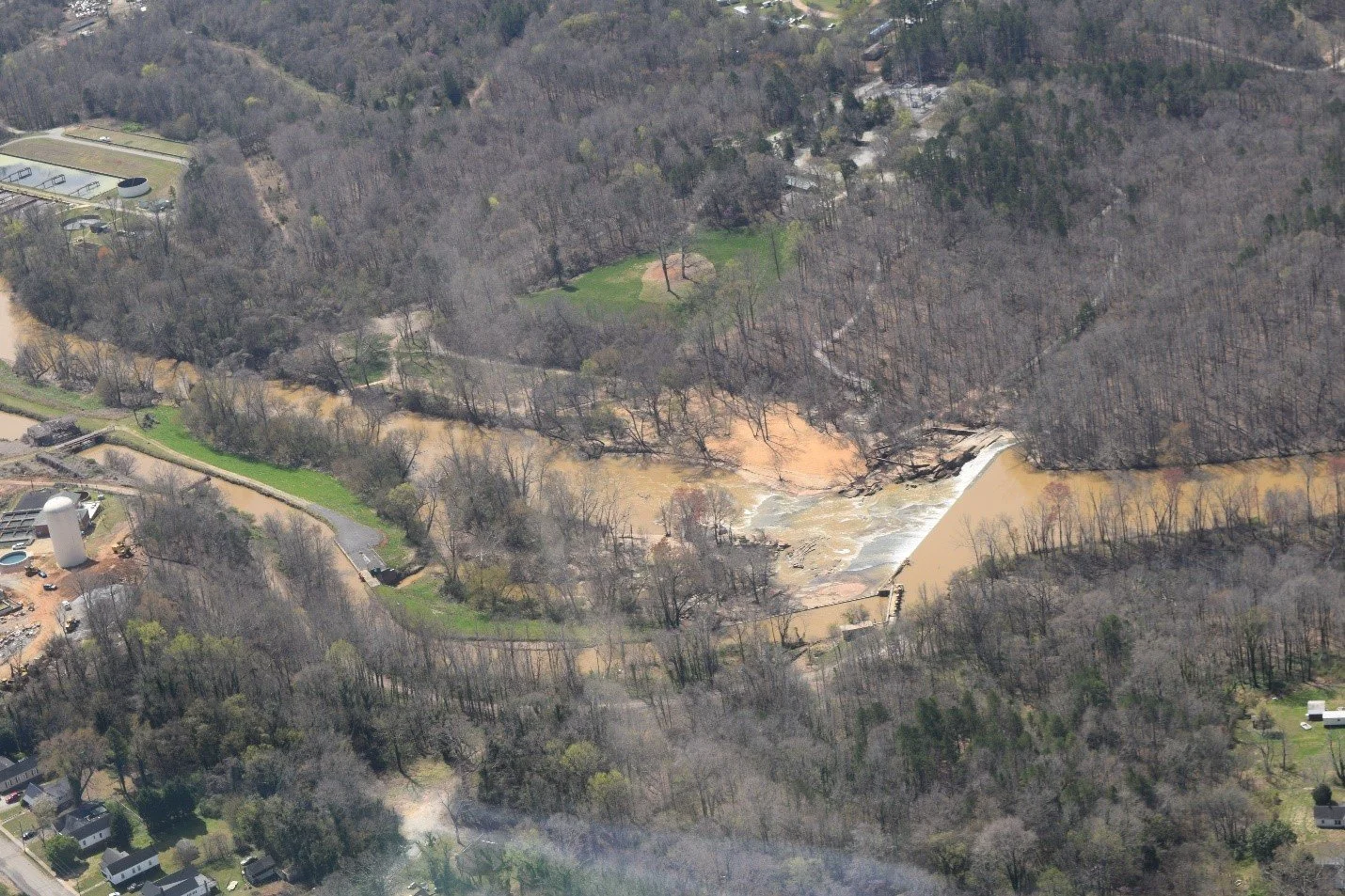
Winston-Salem Forsyth Utilities Swann Treatment Plant water intake dam and somewhat dangerous YRST portage around it.
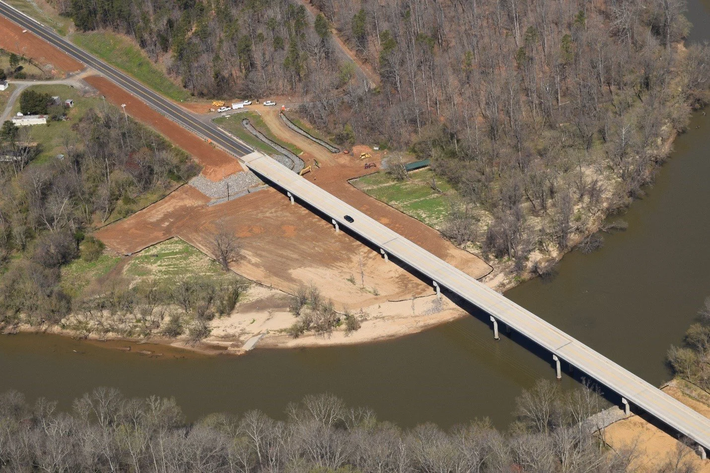
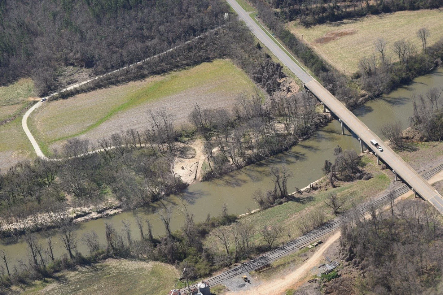
New Highway 67 Bridge Crossing over the Yadkin at Donnaha. Yadkin County and YRK are working to get the access area reopened ASAP.
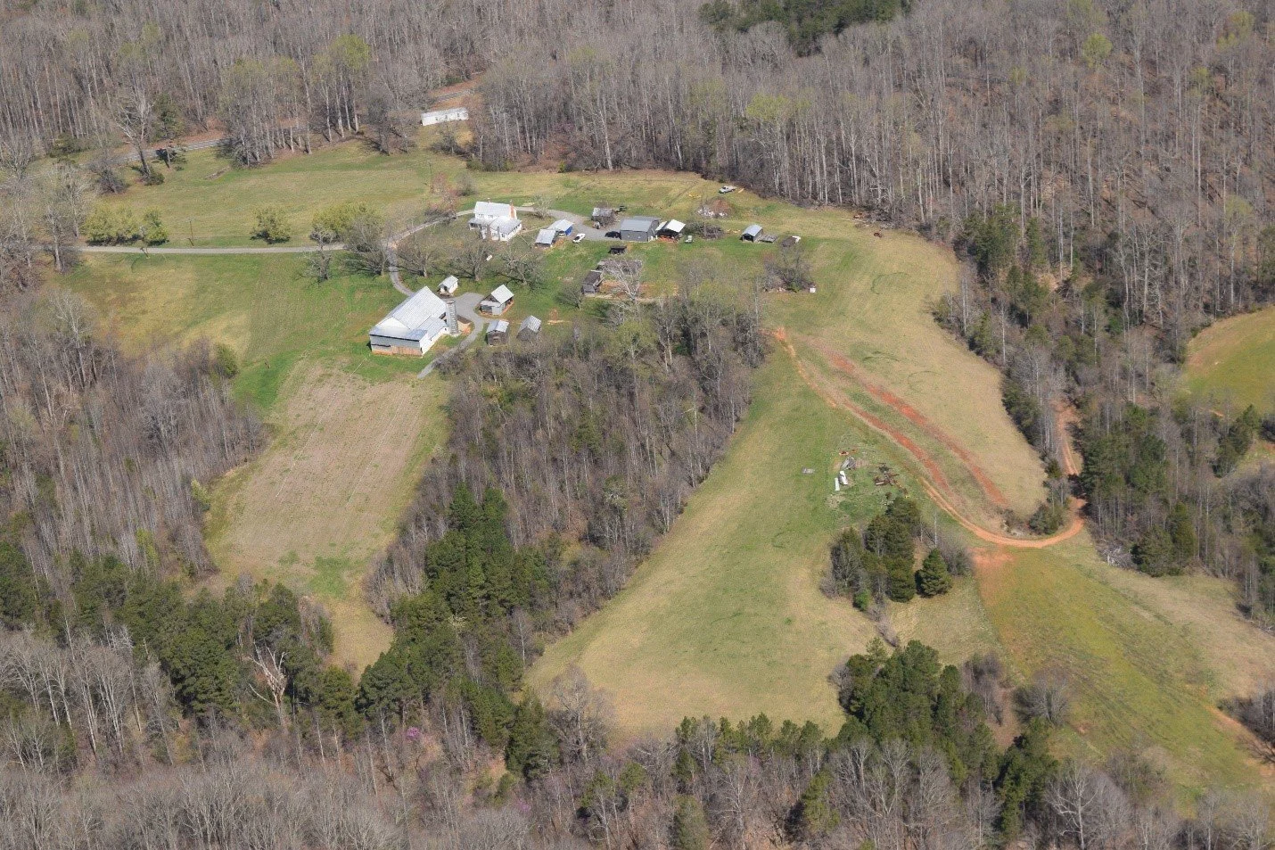
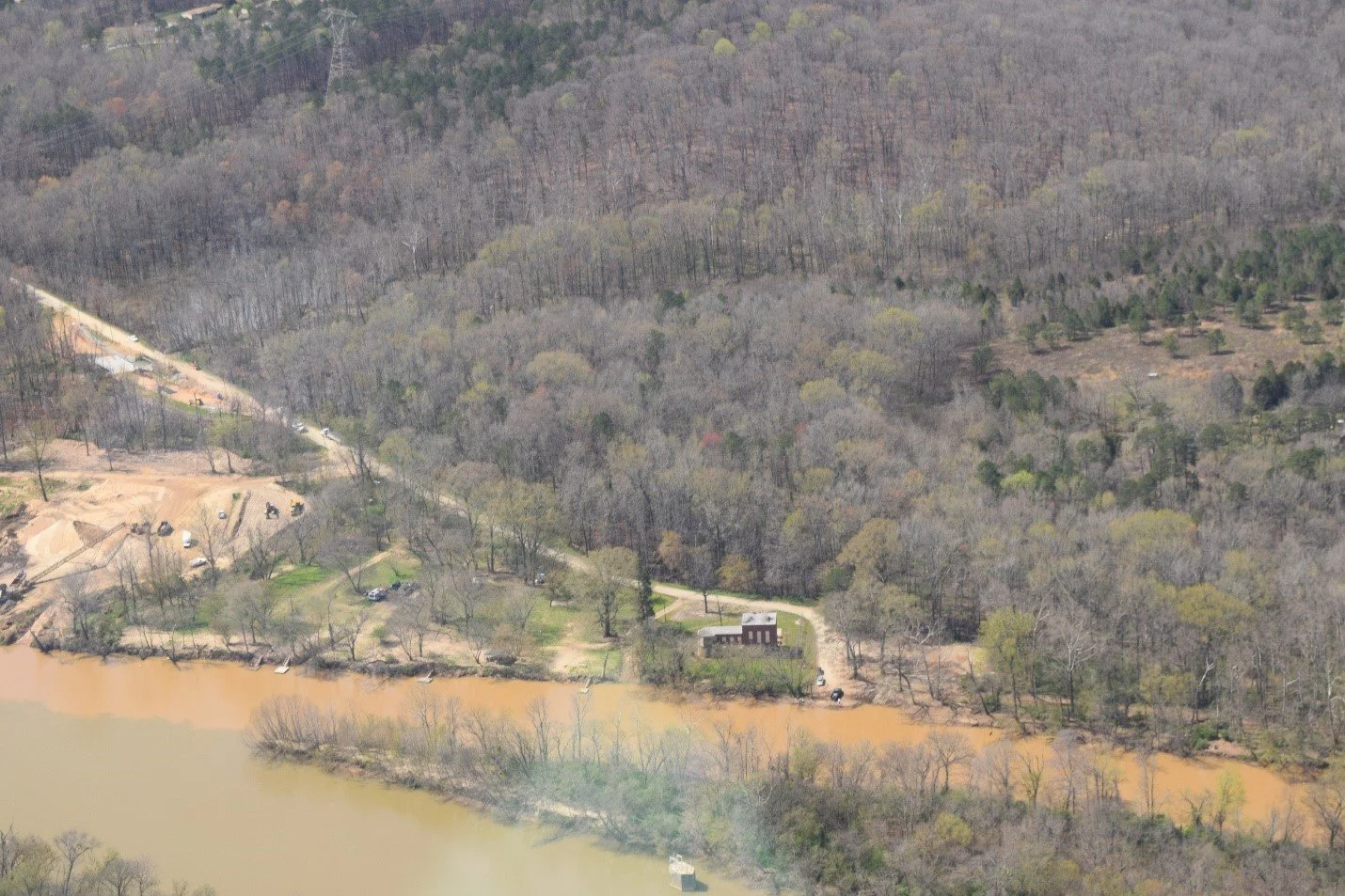
River Ridge Farm, site of YRK’s Farm-to-Fork event on May 11.
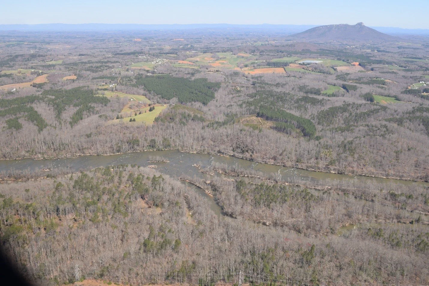
View of both the Yadkin River and Mountain Sections of Pilot Mountain State Park.
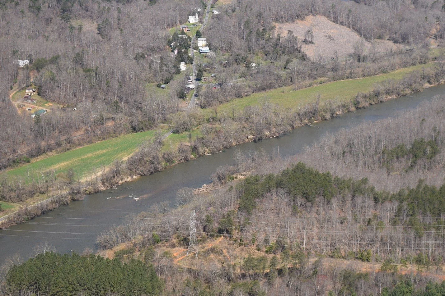
Historic Rockford Village by the Yadkin River, once served as the county seat for the “Tri-county Region,” Surry, Yadkin and Wilkes counties.
Yadkin Shore YRST access at the Highway 601 Bridge, covered in mud and sand and dead, dangerous trees that need to be removed. Camping is strongly discouraged until the dead trees are removed.
Burch Station access area off NC Highway 268 at the confluence of the Yadkin and Mitchell Rivers. Note the new 268 Bridge over the Mitchell top left-hand corner.
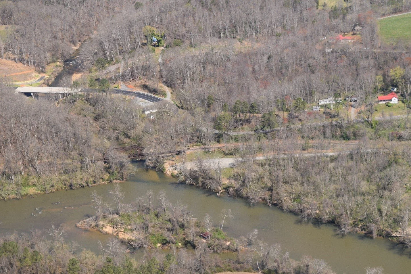
Elkin Carter Park access and Jonesville at Mile 133 on the YRST.
Potential violation of litter pile runoff at a Wilkes County poultry farm.
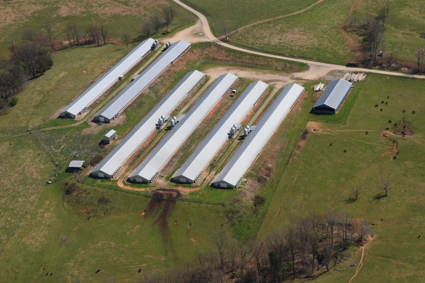
New poultry houses along Highway 421 in Wilkes County. The industry has seen an uptick in growth since 2018, with an estimated 290 million chickens produced annually in the Yadkin Pee Dee watershed according to the US Department of Agriculture. Over application of litter containing phosphorus on already saturated fields and subsequent runoff is a major cause of nutrient pollution in the River and High Rock Lake.
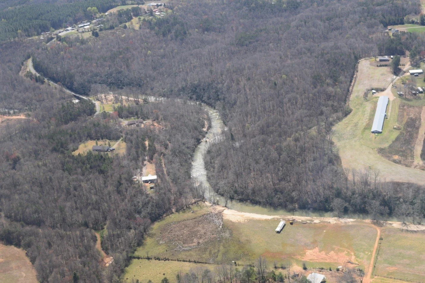
Headed down the meandering South Yadkin in Alexander County. YRK will begin collecting water sampling data from the South Yadkin this summer with funding from the NC Land and Water Fund to be used in the development of a watershed restoration plan.
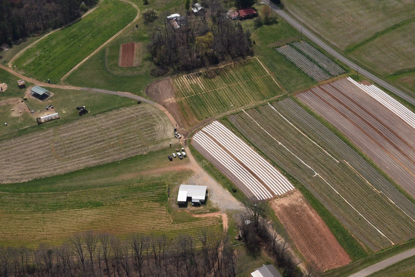
Spring tulip fields at Howard Family Farm in Iredell County near the South Yadkin. Great pick your own operation year-round. Too high up to see the colors.
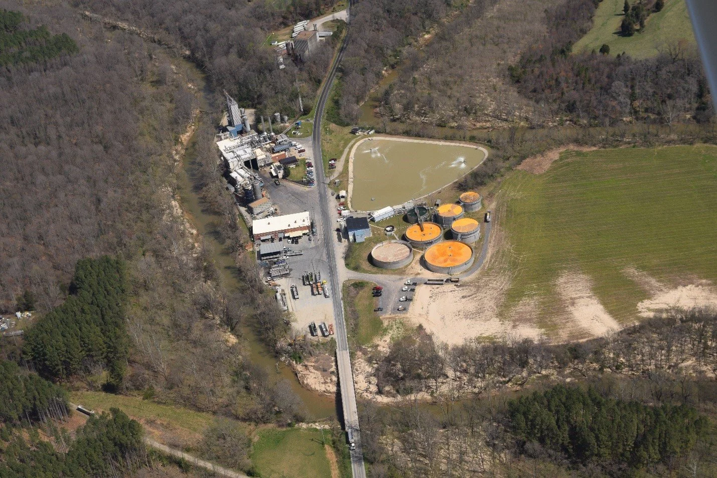
Speaking of colors you don’t really want to see, the orangish wastewater tanks at Tyson’s pet food rendering plant near Harmony, NC, which uses waste from Tyson’s chicken processing plant in Wilkesboro. YRK is still investigating why the tanks are orange and hopes this facility will be required to limit nutrients in its wastewater discharge as part of the High Rock Lake nutrient management rules. The plant is on Hunting Creek, a major tributary to the nearby South Yadkin.
Cooleemee Crossing access on the South Yadkin above Cooleemee Dam and the Riverpark at Cooleemee.
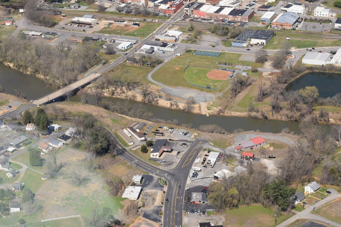
Riverpark at Cooleemee, aka the “Bull Hole.” Newly installed paddle put in top left center.
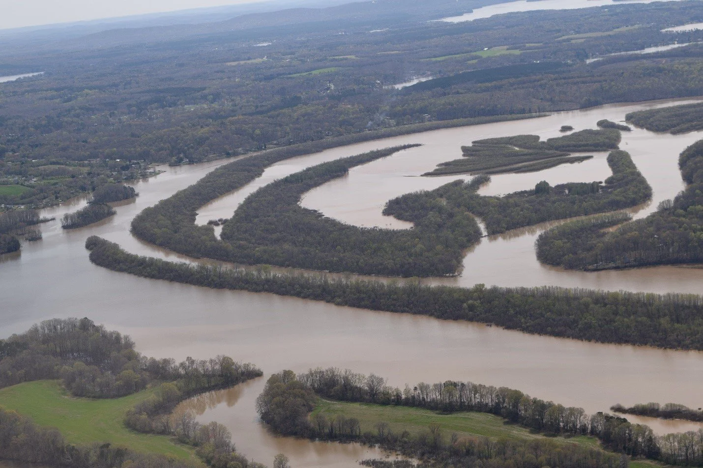
The muddier South Yadkin at its confluence with the Yadkin. The watershed needs some TLC. Salisbury Rowan Utilities soon to be replaced Water Intake Plant and a sand mining operation on the west bank.
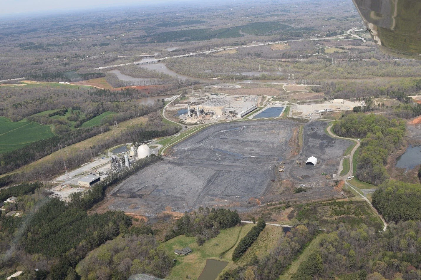
Ongoing excavation of coal ash at Duke Energy’s Buck Power Station on the River in Rowan Co. Thanks to YRK’s lawsuit all coal ash is being excavated, recycled and removed with no long-term disposal on site.
Built up mud flats of Upper High Rock Lake created by nearly 100 years of sediment accumulation.
I hope this photo blog gives YRK members a better sense of the scope of YRK’s work in the watershed and the challenges we face in protecting water quality and providing safe recreational access.
I welcome your comments or questions.
For the River,
Edgar Miller